


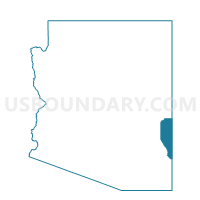
Blue Voting District, Greenlee County, Arizona
About
Outline

Summary
| Unique Area Identifier | 523852 |
| Name | Blue Voting District |
| County | Greenlee County |
| State | Arizona |
| Area (square miles) | 707.41 |
| Land Area (square miles) | 706.62 |
| Water Area (square miles) | 0.79 |
| % of Land Area | 99.89 |
| % of Water Area | 0.11 |
| Latitude of the Internal Point | 33.43945780 |
| Longtitude of the Internal Point | -109.20050480 |
Maps


Graphs
Select a template below for downloading or customizing gragh for Blue Voting District, Greenlee County, Arizona


Neighbors
Neighoring Voting District (by Name) Neighboring Voting District on the Map
- Alpine Voting District, Apache County, AZ
- Catron County Precinct 3, Catron County, NM
- Catron County Precinct 6, Catron County, NM
- Clifton 1 Voting District, Greenlee County, AZ
- Clifton 2 Voting District, Greenlee County, AZ
- Eagle Voting District, Greenlee County, AZ
- Grant County Precinct 35, Grant County, NM
- Morenchi Voting District, Greenlee County, AZ
- York/Sheldon Voting District, Greenlee County, AZ
Top 10 Neighboring County Subdivision (by Population) Neighboring County Subdivision on the Map
- Eagar-Springerville CCD, Apache County, AZ (8,802)
- Clifton CCD, Greenlee County, AZ (5,849)
- Duncan CCD, Greenlee County, AZ (2,588)
- Tyrone CCD, Grant County, NM (2,153)
- Reserve CCD, Catron County, NM (1,802)
Top 10 Neighboring Place (by Population) Neighboring Place on the Map
Top 10 Neighboring Elementary School District (by Population) Neighboring Elementary School District on the Map
- Alpine Elementary District, AZ (463)
- Blue Elementary District, AZ (37)
- Eagle Elementary District, AZ (37)
Top 10 Neighboring Unified School District (by Population) Neighboring Unified School District on the Map
- Silver City Consolidated Schools, NM (21,377)
- Morenci Unified District, AZ (2,878)
- Clifton Unified District, AZ (2,832)
- Reserve Independent Schools, NM (2,071)
Top 10 Neighboring State Legislative District Lower Chamber (by Population) Neighboring State Legislative District Lower Chamber on the Map
- State House District 5, AZ (192,258)
- State House District 49, NM (31,024)
- State House District 38, NM (23,451)
Top 10 Neighboring State Legislative District Upper Chamber (by Population) Neighboring State Legislative District Upper Chamber on the Map
Top 10 Neighboring 111th Congressional District (by Population) Neighboring 111th Congressional District on the Map
Top 10 Neighboring Census Tract (by Population) Neighboring Census Tract on the Map
- Census Tract 9705.02, Apache County, AZ (4,276)
- Census Tract 9764, Catron County, NM (3,725)
- Census Tract 9602, Greenlee County, AZ (2,963)
- Census Tract 9601, Greenlee County, AZ (2,886)
- Census Tract 9603, Greenlee County, AZ (2,588)
- Census Tract 9642, Grant County, NM (2,153)
Top 10 Neighboring 5-Digit ZIP Code Tabulation Area (by Population) Neighboring 5-Digit ZIP Code Tabulation Area on the Map
- 85533, AZ (2,943)
- 85540, AZ (2,874)
- 85534, AZ (2,588)
- 87830, NM (999)
- 88039, NM (465)
- 85920, AZ (464)
- 87824, NM (194)
- 88051, NM (94)
- 85922, AZ (41)